Heavy rain leads to flooding, trail closures, and road damage along North Shore
Updated 11:38 a.m.
Heavy rains and snowmelt along the North Shore and across northern Minnesota have led to flooding at state parks, trail closures, and road damage.
Over the weekend and on Monday, areas received significant precipitation.
Between Duluth and the Canadian border, rainfall totals ranged from 0.5 to nearly 2.31 inches over a 24-hour period, according to April 28 CoCoRaHS data.
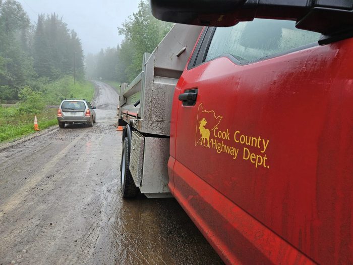
The heavy rainfall has caused flooding on several Cook County roads, leading to washouts and culvert damage.
Cook County Highway Maintenance Superintendent Matt Nesheim told WTIP on Tuesday morning that sections of the Arrowhead Trail, County Road 60, Cardinal Road, and Caspers Hill Road are impacted. Crews are on site at the various locations, conducting repairs. Nesheim said monitoring and repairs of several sinkholes throughout the county are also underway.
Over the weekend, damage was also reported on Perent Lake Road, Chicago Bay Road, and Moose Valley Road. Nesheim said crews spent Monday doing road repairs.
Highway department crews will continue to assess county roads throughout Tuesday. Nesheim said to call the highway department at 218-387-3014 to report damage to county roads.
Forest Service roads throughout the Gunflint Ranger District and the Laurentian Ranger District have also been impacted from the heavy rains. On April 27, the U.S. Forest Service announced that the Shoe Lake Road and the South Brule River Road in Cook County had washed-out sections.
Shoe Lake Road is impassable just west of the intersection of the Arrowhead Trail. South Brule River Road is impassable at Fiddle Creek, near the junction of the Lima Grade.
In the Laurentian Ranger District, Kane Lake Road and Langley Road had experienced road washouts.
Gunflint District Ranger Kyle Stover said that Forest Service crews are still assessing roads as conditions continue to thaw. View the latest Forest Service road conditions here.
Along the North Shore, sections of the Superior Hiking Trail have closed due to the flooding. The High Falls bridge in Tettegouche State Park is currently closed due to flooding.
While impacts have been reported on various sections, the Superior Hiking Trail Association said in an April 27 Facebook post that the “full extent of the impacts along the trail corridor are not known at this time.”
The organization said to check trail condition reports under the Trail Conditions section of its website.
Over the weekend, Gooseberry Falls State Park closed hiking trails next to the Gooseberry River due to high water levels and flooding that created unsafe conditions.
A flood advisory is in effect in Lake and Cook Counties until 6 p.m. on Tuesday due to the recent heavy rains and snowmelt, according to the National Weather Service.
With saturated soils and ongoing moderate rain, the National Weather Service said rivers may continue to rise on Tuesday. Snowpack remains over the inland areas of Cook County.
Drier conditions are expected throughout the remainder of the week. Temperatures will hover in the mid-40s through Friday with partly sunny conditions and minimal precipitation, according to the National Weather Service.
Kalli Hawkins April 28, 2026