Prescribed burns near Gunflint Trail scheduled for this week
Spring prescribed burns are scheduled to begin near the Gunflint Trail starting Tuesday, April 22.
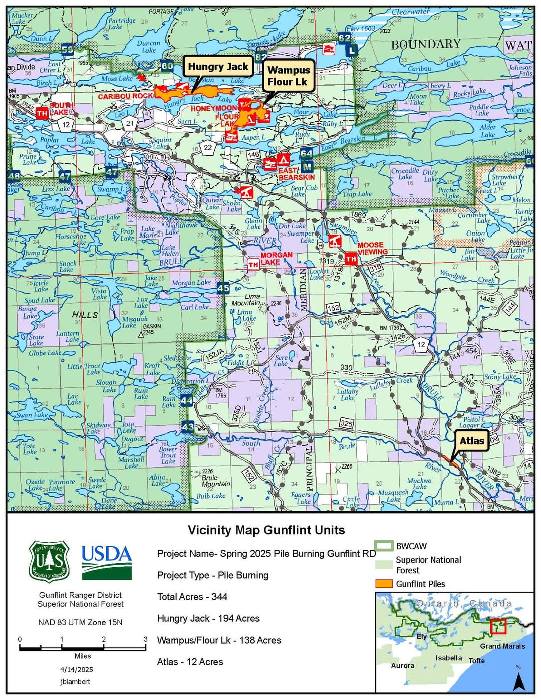
Fire crews with the Superior National Forest East Zone plan to burn 138 acres of piles near the Flour Lake Campground. Prescribed burn signs are staged in the vicinity along Clearwater Rd, near the mid-trail of the Gunflint.
Near Hungry Jack and West Bearskin Lakes, approximately 50 acres of piles are also scheduled to be burned. Over near Greenwood Lake Rd, 15 acres of the Atlas Project will also be burned this week.
Operations will start Tuesday, April 22, and may occur through April 26, according to Mike Crook, a Forest Service forestry technician for the Superior National Forest East Zone.
Crook said operations will start mid-morning and wrap up around 4 p.m.
“The piles are still generally surrounded by several inches of snow and wet forested areas,” Crook said. The fire may continue to smolder and put up smoke for a few days after ignition. The public can expect to see smoke in the immediate vicinity throughout the week.
A map of the Gunflint Trail area prescribed burns is below.
Kalli Hawkins April 21, 2025