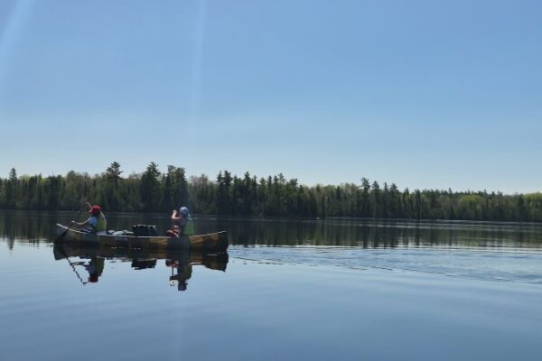
BWCA entry points and permits impacted due to washouts and flooding in the Superior National Forest
Forest Service officials are wrapping up damage assessments and surveys across the 3-million acres of Superior National Forest roads and lands in northeastern Minnesota, following severe thunderstorms and heavy rainfall that occurred on Tuesday, June 18.
Approximately 2 to 8 inches of heavy rainfall was received in a short period of time across much of the national forest. Areas on the western side of the Superior National Forest and Boundary Waters Canoe Area Wilderness (BWCAW) encountered significant flooding and washout conditions, compared to the east side.
“We have roads washed out,” Tofte District Ranger Ellen Bogardus-Szymaniak said. “The west side of the forest is having lots of entry points that are closed for the Boundary Waters.”
Given the flooding and road washout conditions, Forest Service officials have closed BWCAW entry points and canceled permits due to their inaccessibility.
BWCAW permits have been canceled through June 22, 2024, for the following Entry Points:
- Stuart River Entry Point #19
- Angleworm Lake Entry Point #20 and Angleworm Trail Entry Point #21
- South Hegman Lake Entry Point #77
BWCAW permits have been canceled through June 25, 2024, for the following Entry Points:
- Trout Lake Overnight Motor and Day Use Motor Entry Point #1 is inaccessible due to washouts and the motorized portage not being able to operate on the road/trail. Overnight paddle permits are still being issued, and the canoe portage is open.
- Slim Lake Entry Point #6 is inaccessible due to washouts on the North Arm of Burntside Road. From Big Lake, Entry Point #7 is inaccessible due to a major washout on the access road.
- Mudro Lake Entry Point #23 is inaccessible due to a major washout on North Grassy Road.
- Bog Lake Entry Point #67 is inaccessible due to washouts and flooding.
- Island River Entry Point #34 is inaccessible due to washouts and flooding.
- Isabella Lake Entry Point #35 is inaccessible due to washouts and flooding.
- Pow Wow Trail Entry Point #86 is inaccessible due to washouts and flooding.
Forest Service officials said affected permit holders have been notified. “We will reassess conditions and access routes again on June 24, 2024, and determine if the BWCAW permit cancellations need to be extended,” a June 21 Forest Service press release said.
Recreation Sites and Campgrounds
Most developed and dispersed recreation sites, including developed campgrounds in the forest, remain open for visitor use. As road and water conditions change, the Superior National Forest may reevaluate the status of recreation sites. Lake levels are rising, and several boat access docks could be underwater. Due to road washouts and flooding, a handful of campgrounds are closed or only open to high-clearance vehicles. In addition, numerous forest roads are flooded or have washouts, which makes them undrivable, particularly on the west side of the Superior National Forest in St. Louis County and Lake County.
Impacted Forest Roads
In the Tofte Ranger District, primarily on the southeast side of the Forest in Lake and Cook Counties, the following roads are closed:
Tofte Ranger District
- FR 166 (600 Road)
- FR 172 (Wanless Road)
- FR 174 (Dumbell Lake Road)
- FR 177 (Mitawan Lake Road)
- FR 342 (Two Island Lake Road)
- FR 343 (Temperance River Road)
- FR 346 (Richie Lake Road)
- FR 358 (Hoist Lake Road)
- FR 369 (Trappers Lake Road)
- FR 373 (NW Road)
- FR 377 (Tomahawk Road)
- FR 912 (Victor Lake Road)
Flooding has particularly affected forest roads in the northeastern part of the state, but with more rain in the forecast, additional areas could see impacts over the coming days.
“Multiple areas of the northeast were impacted by this week’s heavy rains,” said Matt Huseby, roads coordinator for the DNR’s Forestry Division. “Staff are working to assess flooded roads, washouts, and culvert failures. Please use caution, do not drive on closed roads, and avoid any dangerous conditions you observe.”
More Rain Expected over the Weekend
More rain is expected across areas of northeastern Minnesota starting Saturday, June 22.
“Right now it’s about one to one and a half inches of rainfall is what we have in our forecasts,” National Weather Service meteorologist Woody Unruh said. “We’re definitely keeping a very close eye on it given that soils are very saturated.”
Kalli Hawkins June 22, 2024