Additional Forest Service personnel and resources arrive in Grand Marais
Two U.S. Forest Service public information officers and additional resources arrived in Grand Marais on Thursday afternoon to respond to the Little Knife Fire.
The Little Knife Fire originated from two Canadian wildfires that merged near Ottertrack and Knife Lake near the U.S./Canada border. Overnight on Tuesday, the fire crossed the border into the U.S.
With the fire now burning within the U.S., officials with the Forest Service have begun deploying resources and personnel and begun suppression efforts. The latest estimated size of the fire on the U.S. side is 6,000 acres. The Little Knife Fire has burned as far south as Ogishkemuncie Lake in Lake County, approximately four miles from the western edge of Seagull Lake.
Steve Long and Sadie Brown are the two new personnel stepping into the role to assist with communication and information coordination amid the Forest Service’s response to the Little Knife Fire.
Long and Brown, joined by Gunflint District Ranger Kyle Stover and Laurentian District Ranger Adam Cochran, stopped by WTIP shortly after noon Thursday. Long and Brown will be stationed at the Gunflint District Ranger station in Grand Marais.
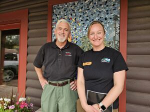
U.S. Forest Service Public Information Officers Steve Long and Sadie Brown | Photo by Kalli Hawkins
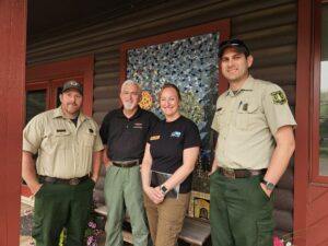
U.S. Forest Service Personnel Adam Cochran, Steve Long, Sadie Brown, Kyle Stover stop by WTIP | Photo by Kalli Hawkins
Forest Service vehicles transporting canoes and equipment were visible throughout Grand Marais and along the Gunflint Trail on Thursday.
Stover said as of noon on Thursday, Forest Service aircraft have been unable to fly near the Little Knife Fire due to the heavy smoke and poor visibility.
Farther west across the BWCAW and Superior National Forest, aircraft have also been limited in fire operations due to the conditions.
“Due to dense smoke, aircraft have been challenged with conducting air operations and reconnaissance missions for updated acres and areas of fire progression,” the Forest Service said in a Thursday morning press release.
When visibility and smoke conditions improve, the Forest Service plans to conduct an aerial flight to get a better estimate of the fire’s size and its behavior.
As of Thursday, there are 15 active wildfires, with three active fires inside the Boundary Waters Canoe Area Wilderness(BWCAW). The Forest Service said, “Some fires have merged or been moved into patrol status.”
Forest Service officials said that fire growth across the Superior National Forest on Wednesday was moderated slightly by cloud cover, lighter winds, and an increase in humidity. However, officials said on Thursday morning, “Today will be another active fire day as the vegetation continues to dry and carry fire intensely.”
Across the northern regions of the BWCAW, the Thumb Fire has increased in size to nearly 15,400 acres. The Bear Trap Fire which crossed into Canada this week, has burned 34, 421 acres. 13,500 acres of which is within the U.S.
Stay informed on the latest at: https://wtip.org/live-updates-wildfires-and-response-across-superior-national-forest-and-bwcaw/
Kalli Hawkins July 16, 2026