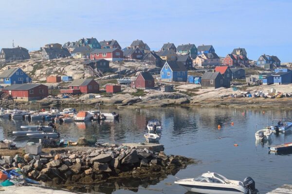
Quetico wildfires move closer to the end of the Gunflint Trail and BWCA
International borders, county lines, wilderness boundaries and other features on maps play little role in where and how intense a wildfire is going to burn.
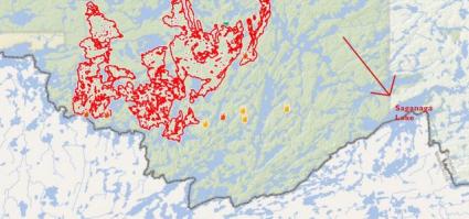
Take the massive and numerous wildfires burning in Quetico Provincial Park this summer, for example. There is a wildfire that is nearly 100,000 acres actively burning in Quetico as of Friday, Aug. 27. The fire poses a threat to jump the border from Quetico and into Minnesota. That being the case, and despite an abundance of media from around the nation swarming to northeastern Minnesota this week to report on the Greenwood Fire and the closure of the Boundary Waters Canoe Area Wilderness, there is rarely any mention of this massive wildfire located just across the border.
A major distinction between the two fires is that the Greenwood Fire is burning near a highway and threatens property and structures. The fire has destroyed at least a dozen homes or cabins this week, burning numerous other structures this week as well. Meanwhile, the fires in Quetico are burning in a remote wilderness area. The immediate threat to private property is minimal if the fires stay inside the park’s boundaries. For some, the term ‘if’ is the key word in this scenario.
Chris Marchand is the fire information officer for the Northwest Division of Ontario Aviation, Forest Fire and Emergency Services. He confirmed with WTIP that numerous wildfires are burning in Quetico at this time, including three new fires that were discovered Aug. 26 near Agnes Lake. These fires add to several existing fires already burning in the park. One of those three new fires has been brought under control by firefighters, while the two remaining starts are not under control, according to Marchand.
Another new fire was reported in Quetico Aug. 27 just east of Agnes Lake. This fire, though less than half an acre is size, is reported as ‘not under control’ and is approximately 12 miles from the Cache Bay Ranger Station and adjoining Saganaga Lake at the end of the Gunflint Trail.
The most notable fire in Quetico at this time is being called ‘Fort Frances 35.’ This fire has been burning since June 9 and has since merged with several neighboring fires to become 98,842 acres in size as of Aug. 27.
There are suppression efforts working the Fort Frances 35 Fire, according to Marchand. A total of nine firefighting teams, with four-people per crew, are establishing a line with hoses in strategic locations and utilizing bucket support from heavy and intermediate helicopters, he added.
Marchand told WTIP that precipitation is expected in Quetico this weekend, which should help lower fire behavior and reduce the potential for new fires due to lightning.
“We’ve seen drought conditions basically throughout most of northwestern Ontario all summer,” he said. “Quetico hasn’t seen the rain that most other areas in the region have seen, and it’s showing some persistent high fire behavior.”
Quetico closed to all backcountry access earlier this month.
WTIP has been reporting on the Quetico wildfires and their impact on the 2021 paddling season since July.
Joe Friedrichs August 27, 2021