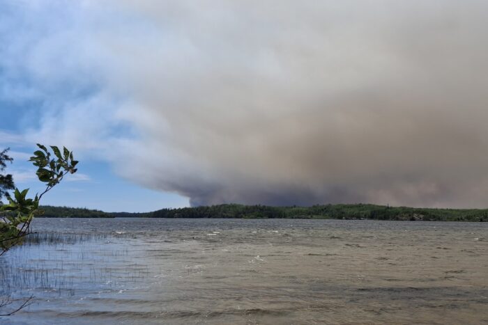
Forest Service adds firefighting resources to Little Knife Fire response near end of Gunflint Trail
Overnight on Tuesday, two Canadian wildfires that have been burning near Ottertrack and Knife Lake merged and then crossed over the border into the U.S.
Now, on the U.S. side, it has been designated as the Little Knife Fire and has burned approximately 6,000 acres as of Wednesday morning.
With the fire now burning within the U.S., officials with the U.S. Forest Service can respond and begin suppression efforts.
“There’s going to be a lot of aircraft involved,” said Kyle Stover, Gunflint District Ranger, during a wildfire update at a July 14 Cook County Board of Commissioners’ meeting.
Stover told WTIP on Wednesday that additional Forest Service firefighting resources are being deployed to Cook County to respond to the Little Knife Fire. The Forest Service also plans to add two public information officer staff members who will assist with communication and information coordination.
Forest Service wilderness rangers are actively conducting sweeps to contact BWCAW campers about the wildfires and BWCAW closure that took effect on Tuesday, Stover told WTIP.
On Wednesday afternoon, the wildfire is primarily moving in a north to south direction, Stover said. The Little Knife Fire has burned as far south as Ogishkemuncie Lake in Lake County, approximately four miles from the western edge of Seagull Lake.
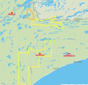
Location of Little Knife Fire and Cook County evacuation ‘Set’ and ‘Ready’ zones
“Due to the conditions and the smoke, we have not been able to do a flight on that for recon,” said Nick Petrack, the fire staff officer for the Superior and Chippewa National Forest during a Wednesday press conference.
When visibility and smoke conditions improve, the Forest Service plans to conduct an aerial flight to get a better estimate of the fire’s size and its behavior.
“Things are very dynamic,” Petrack said.
Stover told WTIP on Wednesday that the two Canadian wildfires that merged were FOR028 and a neighboring wildfire, FOR012. In Ontario, the two fires have burned approximately 30,000 acres.
Due to the southern expansion of the fire into the U.S., the Cook County Sheriff’s Office, in coordination with the Forest Service, decided to expand the evacuation zones into the mid-trail area of the Gunflint Trail. The area is now in a ‘Ready’ status.
In the northern regions of the Schroeder, Tofte, and Lutsen Townships, an evacuation zone has also been added and designated as ‘Ready’ status.
The evacuation zone designation for the end of the trail remains at a ‘Set’ status. Cook County Sheriff Ben Hallberg told WTIP that the evacuation zone towards the end of the Gunflint Trail consists of approximately 147 properties.
The Cook County Sheriff’s Office said on Wednesday that Code Red messaging will also be sent to the new ‘Ready’ areas.
Cook County uses the “Ready, Set, Go” method for emergency evacuations; here are the basics.
- READY for potential evacuation. Create an evacuation plan and ensure all household members are familiar with it. Gather all emergency supplies and create an emergency supply kit. Be up to date with your insurance and take a video home inventory. Closely monitor the situation.
- SET to evacuate. Prepare to leave at a moment’s notice! Start packing your vehicle and back your car into the driveway to ensure quick and seamless evacuation. If you feel threatened, don’t wait for a final evacuation notice; just go!
- GO! Evacuate immediately! Make sure all household members are accounted for. Have several predetermined evacuation routes planned and choose the safest one. Head to your designated safe location (relative’s house, motel, etc.). GO!
Read a WTIP article about how property owners can prepare for wildfires here: https://wtip.org/authorities-encourage-wildfire-preparedness-along-gunflint-trail-and-across-the-county/
Kalli Hawkins July 15, 2026