The latest: Wildfires and response across Superior National Forest and BWCAW
Over a dozen active wildfires continue to burn within the Superior National Forest, and Boundary Waters Canoe Area Wilderness (BWCAW). Quetico Provincial Park and Ontario also have numerous fires. Cook County authorities are monitoring the Little Knife Fire, which began in Canada and has crossed over into the U.S.
WTIP will continue to update this post with more information regarding the wildfires affecting Superior National Forest and the Arrowhead region.
Share photos of smoke conditions, weather observations, or other updates by emailing news@wtip.org
Cook County Launches Wildfire Response Hub
1:30 p.m., Thursday
Cook County has transitioned to a more permanent and user‑friendly Wildfire Response Hub, which the public can access here: https://wildfire-
The county will keep the page up to date with items that specifically related to Cook County Government’s responsibilities, actions, and community guidance during wildfire activity while directing the public to the US Forest Service for current fire behavior, containment status, maps, and incident-level updates.
Additional BWCAW entry points and recreational sites reopen as wildfire conditions improve
Noon, Thursday
The Superior National Forest is reopening additional portions of the Boundary Waters Canoe Area Wilderness (BWCAW) as wildfire activity has decreased and recent precipitation has helped moderate conditions.
The newly reopened entry points will allow both day-use and overnight BWCAW permits beginning July 30 and July 31, according to the U.S. Forest Service. The reopened areas include entry points in Cook, Lake and St. Louis counties.
The Forest Service said the decision follows continued progress on wildfire suppression efforts and changing weather conditions.
Read the latest in a WTIP article here: https://wtip.org/additional-bwcaw-entry-points-and-recreational-sites-reopen-as-wildfire-conditions-improve/
Little Knife Fire Public Meeting – July 29 at Gunflint Trail Fire Hall #1
7 p.m., Wednesday
Officials with the National Incident Management Organization (NIMO), the U.S. Forest Service, and the Gunflint Trail Volunteer Fire Department held a public meeting on July 29 at Fire Hall #1 in the mid-trail area of the Gunflint Trail to provide an update on the Little Knife Fire. Photos and audio below of the meeting.


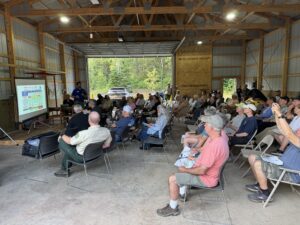
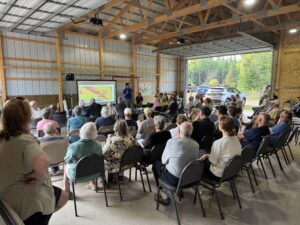
WTIP Speaks with Public Information Officers on Wednesday, July 29, about Little Knife Fire
Public information officers Steve Long and Peg Robertson spoke with Kalli Hawkins on Wednesday to provide the latest updates on the Little Knife Fire. Long and Robertson share insights on the internal operations of the NIMO team, communication and coordination with the hotshot crews on the ground, strategies fighting a fire along the U.S/Canada border, and more. Audio below.
Little Knife Fire – public informational meeting on July 29
7 p.m., Tuesday
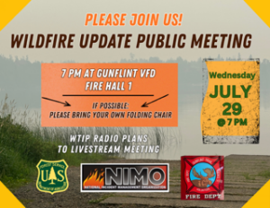
The Gunflint Trail Volunteer Fire Department, in collaboration with the U.S. Forest Service, and the NIMO team, will hold a meeting at the Gunflint Trail Fire Department Hall #1 next to the Schaap Community Center on Wednesday, July 29, at 7 p.m.
WTIP will also be live broadcasting the public meeting on our frequencies: 90.7 FM WTIP Grand Marais, 90.1 FM WGPO Grand Portage, and 89.1 WKEK Gunflint Lake. The live broadcast will be available via streaming on our website wtip.org and on the WTIP App. Access the WTIP website here: www.wtip.org.
New NIMO team takes over Little Knife Fire response
5 p.m., Tuesday
Over the last several days, the National Incident Management Organization (NIMO) has undergone a transition, as the first NIMO team assigned to the Little Knife Fire has handed over management of the incident to a second NIMO team that recently arrived in Cook County.
NIMO incident management teams typically consist of about 10 personnel and rotate assignments every two to three weeks to provide continued leadership during extended fire responses.
As of Tuesday, July 28, the Little Knife Fire, which originated in Canada and crossed into the U.S. near the end of the Gunflint Trail, remains at roughly 4,958 acres.
The fire also remains at 49% containment, according to the latest update from fire officials.
Public Information Officer Steve Long said NIMO teams are among the most experienced incident management teams in the country, and the transition process includes extensive briefings between teams to ensure the incoming team understands current fire conditions, suppression efforts, and operational plans.
“The transition is official,” Long said. “Authority has been given to the new NIMO team to manage the fire.”
The majority of the NIMO team has moved its operations from the Cook County Community Center to near the end of the Gunflint Trail, placing incident management personnel closer to the fire area and crews working in the field.
According to the Forest Service, 128 firefighting personnel are currently assigned to the Little Knife Fire.
Read the full WTIP article here: https://wtip.org/new-nimo-team-takes-over-little-knife-fire-response-community-thanks-firefighters/
Cook County officials, state leaders begin planning wildfire economic recovery
3 p.m., Tuesday
As firefighters continue working to contain wildfires burning throughout the Superior National Forest and Boundary Waters Canoe Area Wilderness, local and state leaders are beginning to shift their focus from emergency response to helping businesses recover from weeks of BWCAW closures and wildfire-related impacts.
Cook County/Grand Marais Economic Development Authority Director Lucas Wakefield said local organizations are working together to document the financial impacts on Cook County businesses and advocate for state and federal assistance.
“We’re in a period of deep concern and need for action,” Wakefield said. “A lot of entities have come together and said, ‘How can we work together?'”
During a wildfire briefing Monday in Ely, Mayor Heidi Omerza thanked the firefighters, emergency responders and agencies working to protect the region, along with residents who have remained patient throughout the wildfire response.
Omerza said she expects state leaders to play an important role in helping communities recover economically.
“I’m going to be leaning on everybody who loves Ely to help us move forward,” she said.
Read the full WTIP article here: https://wtip.org/cook-county-officials-state-leaders-begin-planning-wildfire-economic-recovery/
WTIP Speaks with Public Information Officers on Tuesday, July 28, about Little Knife Fire
Public information officers Steve Long and Peg Robertson spoke with Kalli Hawkins at noon on Tuesday to provide the latest updates on the Little Knife Fire.
Sen. Grant Hauschild, Rep. Roger Skraba, and Cook County Chamber of Commerce to Discuss Economic Impact of Northland Wildfires
7 a.m., Tuesday
Senator Grant Hauschild and Representative Roger Skraba, and the Cook County Chamber of Commerce, along with other partners will discuss the economic impact of Northland wildfires on tourism and other industries on Friday, July 31 at 11:30 a.m. at Hungry Jack Lodge on the Gunflint Trail in Grand Marais.
For the public that is unable to attend the roundtable discussion, WTIP will be live streaming via video and audio on our WTIP Facebook page. Link here: https://www.facebook.com/WTIPNorthShoreCommunityRadio/
WTIP will also be live broadcasting the public meeting on our frequencies: 90.7 FM WTIP Grand Marais, 90.1 FM WGPO Grand Portage, and 89.1 WKEK Gunflint Lake. The live broadcast will be available via streaming on our website wtip.org and on the WTIP App. Access the WTIP website here: www.wtip.org.

Overnight access returns to portions of the BWCAW
7 p.m., Monday
Areas of the Boundary Waters Canoe Area Wilderness (BWCAW) will reopen to day-use and overnight access starting Thursday, July 30.
On Monday, the U.S. Forest Service announced it will enter Phase 2 of the reopening process, with roughly 41 entry points in the central and eastern portions of the wilderness area reopening.
The areas selected for reopening represent roughly 39 percent—or just over 400,000 acres of the BWCAW.
The Phase 2 list includes all the same entry points as Phase 1 and adds several entry points in Lake and Cook Counties. Select entry points in Cook County had reopened for day-use access only on Monday. There is only one entry point reopening in St. Louis County: Trout Lake for day-use motor only.
Day-use motor is also opening on Seagull and Saganaga Lakes in Cook County.
All other entry points will stay closed while multiple wildfires continue to burn in the area. Forest Service officials said permits for these entry points have been canceled from July 30 through August 3.
Read the full WTIP article here: https://wtip.org/overnight-access-returns-to-portions-of-the-bwcaw/
See a map below of the BWCAW entry points reopening for both day-use and overnight effective July 30.
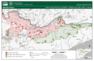
BWCAW entry points reopening for both day-use and overnight effective July 30 | USFS
Cook County Airport becomes hub for wildfire response
4 p.m., Monday
Substantial resources have been brought to Cook County to help contain the Little Knife wildfire–both human and airborne. WTIP recently spoke with Grand Marais/Cook County Airport Manager Rodney Roy about the specialized aircraft currently occupying parts of the tarmac.

Cook County Airport Manager Rodney Roy with Chinook | Photo by Chuck Olsen
Read the full article and view photos here: https://wtip.org/cook-county-airport-becomes-hub-for-wildfire-response/
Full audio of the interview below:
Gov. Tim Walz addresses northland wildfires & economic aid plans on July 27
Below is a video recording of the July 27 press briefing in Ely with Gov. Tim Walz and state, federal, and county officials to address the wildfires throughout northern Minnesota and the economic aid plans. Video courtesy of MPR.
WTIP Speaks with Public Information Officers on Monday, July 27, about Little Knife Fire
Public information officers Steve Long and Peg Robertson spoke with Sterling Anderson during Noon News Hour to provide the latest updates on the Little Knife Fire.
WTIP – Boundary Waters Podcast Ep. 132 – Fire Season
10 a.m., Monday
Listen below to the latest WTIP Boundary Waters Podcast which features an interview with Ely resident and Wilderness guide LynnAnne Vesper after she was evacuated from her home due to the Camp Fire – the closest of several fires burning in the Superior National Forest, the Boundary Waters Wilderness and Quetico Provincial Park.
Cook County eases Gunflint Trail evacuation status as Little Knife Fire containment grows
5 p.m., Sunday
The Cook County Sheriff’s Office announced Sunday evening that evacuation zones along the Gunflint Trail will be reduced beginning Monday, July 27, following continued containment of the Little Knife Fire.
The decision comes after a team of hotshot and smokejumper crews was inserted on the ground over the weekend near the Little Knife Fire and after consultation with the U.S. Forest Service and National Incident Management Organization (NIMO), the sheriff’s office said.
As of Sunday evening, the sheriff’s office said containment of the Little Knife Fire is 49%.
Effective Monday, July 27, the Sheriff’s Office will remove all ‘Ready’ evacuation zones in the mid-trail area of the Gunflint Trail, designated as Gunflint Districts 2, 3, and 4.
Towards the end of the Gunflint Trail, the area has been in a ‘Set’ designation. Starting Monday, the evacuation order will be reduced to a ‘Ready,’ reflecting improved conditions.
Read the full article here: https://wtip.org/cook-county-eases-gunflint-trail-evacuation-status-as-little-knife-fire-containment-grows/
Find the maps and more information on ‘Know Your Zone’ here: https://cookcountymn.maps.arcgis.com/apps/webappviewer/index.html?id=2f0cb0740663455e9fe5c47b7fdb2379&fbclid=IwY2xjawTTaQRwZG9mAWV4dG4DYWVtAjExAHNydGMGYXBwX2lkEDIyMjAzOTE3ODgyMDA4OTIAAR6UhXiEuJyXB259eXUcaTv0gDf0SRFGKSsbkZ_F1R-eekWH-s_JEg3o5q0hOA_aem_50sU6i0baed-pDP8cnMZvw
Learn more emergency evacuation information here: https://cookcountymn.gov/government/departments/emergency_management/emergency_evacuation_reminders.php
Strategic Operations Briefing for Little Knife Fire by NIMO Operations Section Chief Jen Rabuck – July 26
Forest Service plans to reopen BWCAW entry points for overnight permits
The U.S. Forest Service said it expects to reopen overnight permits for select entry points in the Boundary Waters Canoe Area Wilderness on July 30, provided no significant wildfire activity occurs over the weekend.
The announcement came in a Friday morning press release. Forest Service officials said they will make a final decision and announce implementation of the proposal on Monday, July 27.
If approved, overnight access would resume at 37 of the BWCAW’s 103 quota entry points. The locations included in this phase are the same entry points expected to reopen for day use on July 27, and add several entry points in Lake County.
WTIP speaks to community about their wildfire experience
Over the past week, members of WTIP spoke with community members throughout Grand Marais about how the wildfire and air quality have affected their businesses.
WTIP Speaks with Public Information Officers on Friday, July 24, about Little Knife Fire
Public information officers Steve Long and Peg Robertson spoke with Matthew Brown and Steph Vos during North Shore Morning to provide the latest updates on the Little Knife Fire.
Tuscarora Lodge & Canoe Outfitters reflects on impact of BWCAW closures

WTIP’s Kalli Hawkins stopped by Tuscarora Lodge & Canoe Outfitters this week to speak with Andy McDonnell, one of the owners about how they are navigating the BWCAW closures and the impact it is having on the business. Audio below.
Seagull Canoe Outfitters owners Grant and Christina Hopke continue to navigate BWCAW closures
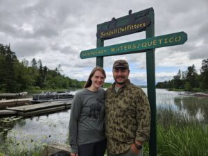
WTIP’s Kalli Hawkins stopped into Seagull Canoe Outfitters this week to learn how owners Grant and Christina Hopke are navigating the BWCAW closures and the impact it has on their business towards the end of the Gunflint Trail. Audio below.
Parts of BWCAW to reopen for day use Monday in Cook County
Noon, Thursday
Areas of the Boundary Waters Canoe Area Wilderness (BWCAW) will reopen on Monday, July 27, for day-use access only at select points of entry within Cook County.
Day use at other entry points in the BWCAW on the western side within Lake and northern St. Louis County remains closed, the U.S. Forest Service announced on Thursday shortly before noon.
While day-use access will be allowed at select points of entry, all overnight access will remain closed through Wednesday, July 29. The Forest Service said, “No overnight camping is currently allowed.”
The BWCAW entry points that will open to day use only in Cook County starting Monday include areas along the western edge of the county, areas along the Gunflint Trail, and towards the end of the Arrowhead Trail. On the western edges of Cook County, entry points such as #38 Sawbill Lake, #39 Baker Lake, #40 Homer Lake, and #41 Brule Lake will open for day use starting Monday. Areas along the Gunflint Trail include BWCAW entry points such as #60 Duncan Lake, #50 Cross Bay Lake, #51 Missing Link Lake, and #64 East Bearskin, along with many others. See a full map below.
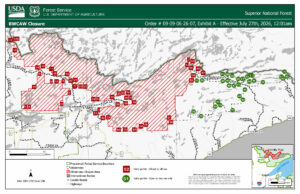
Map of BWCAW entry points in green that will open for day use starting Monday in Cook County | USFS
The Forest Service said it anticipates the ability to open select portions of the BWCAW entry points in Cook and Lake Counties this next week to overnight use – as long as there is no significant wildfire activity over the upcoming weekend.
Read the full article here: https://wtip.org/parts-of-bwcaw-to-reopen-for-day-use-monday-in-cook-county/
WTIP speaks with Tim Norman about his history as a firefighter and pilot
WTIP’s Chuck Olsen sat down with Tim Norman at the Tofte Fire Department Hall to talk about his experience working on wildfires in the Superior National Forest and in Cook County, including, the Cavity Lake Fire, Ham Lake Fire, Sag Corridor Fire, and others. Norman talks about how U.S. works with Canada for cross-border firefighting efforts and how the scale of the current wildfire season compares to years past. Audio below.
WTIP Speaks with Public Information Officers on Thursday, July 23, about Little Knife Fire
Public information officers Steve Long and Peg Robertson spoke with WTIP’s Kalli Hawkins to provide an update on the Little Knife Fire and efforts to keep Cook County residents informed. Additional fire personnel have arrived in Grand Marais, which include 23 hotshot crews and 13 smokejumpers. The crews are going through canoe training and will be inserted on the ground near the Little Knife Fire in the coming days. Audio below.
Cook County Sheriff’s Office lifts evacuation orders for Schroeder, Tofte, and Lutsen
8:15 p.m., Wednesday
Given the reduced activity of the Little Knife Fire in recent days and the recent arrival of National Incident Management Organization (NIMO), the Cook County Sheriff’s Office lifted the ‘Ready’ evacuation orders on Wednesday for the Schroeder, Tofte, and Lutsen areas. The area had been placed in a ‘Ready’ designation following the Little Knife Fire crossing the U.S. border and making a sizeable run overnight to nearly 5,ooo acres.
The area towards the end of the Gunflint Trail remains in a ‘Set’ designation and the mid-trail area remains in a ‘Ready’ designation.
“There is some weather coming in over the weekend that we need to keep an eye on for fire activity,” said Cook County Sheriff Ben Hallberg. “We are continuing to evaluate the evacuation zones, with assistance from the USDA Forest Service and the National Incident Management Organization (NIMO) for possible changes.”
Temperatures in the 70s and 80s are forecasted to return across the Arrowhead region starting Thursday. A couple rounds of storms are possible, according to the National Weather Service.
View the latest evacuation information for Cook County on the county’s Know Your Zone website here: https://cookcountymn.maps.arcgis.com/apps/webappviewer/index.html?id=2f0cb0740663455e9fe5c47b7fdb2379
NIMO develops long-term strategy for Little Knife Fire as additional crews arrive
8 p.m., Wednesday
Over the weekend, the National Incident Management Organization (NIMO) took command of the Little Knife Fire.
For the next two weeks, the NIMO team will be stationed at the Cook County Community Center as it assists with coordinating emergency response efforts to the Little Knife Fire and other fires across northern Minnesota.
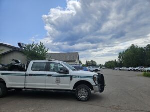
NIMO and Forest Service officials stationed at the Cook County Community Center | Photo by Kalli Hawkins
County officials signed a contract with NIMO on July 20 for use of the community center and the log cabin building for two weeks. County officials said in a special meeting this week that after the two weeks, the use of the facilities will be assessed on a day-by-day arrangement.
The NIMO team is tasked with identifying “values,” such as structures, cabins, infrastructure, and businesses in the surrounding vicinity of the fire that may be at risk. Then, develop a long-term strategic plan to mitigate risk and protect those values.
The areas of priority are east of the Little Knife Fire along the Gunflint Trail corridor, where the NIMO team has identified several structures, lodges, cabins, commercial buildings, communication towers, and associated infrastructure, said Jason Loomis, the NIMO Incident Commander for the Little Knife Fire during a Wednesday press conference.
Learn the latest information about what we know about the Little Knife Fire as of Wednesday in a WTIP article here: https://wtip.org/nimo-develops-long-term-strategy-for-little-knife-fire-as-additional-crews-arrive/
FAQ: What to know about wildfire emergency preparedness in Cook County
12:15 p.m, Wednesday
Have questions about BWCAW closures, air quality, evacuation orders, and Firewise best practices?
A lot of information has been shared over the past week. To help answer the questions we hear most often, WTIP has compiled a wildfire FAQ.
Read the full article here: https://wtip.org/faq-what-to-know-about-wildfire-emergency-preparedness-in-cook-county/
Video: Superior National Forest – operational briefing for July 22
WTIP Speaks with Public Information Officers on Wednesday July 22, about Little Knife Fire
11 a.m., Wednesday
Public information officers Steve Long and Sadie Brown joined WTIP Executive Director Matthew Brown on North Shore Morning to provide an update on the Little Knife Fire and efforts to keep Cook County residents informed.
Long and Brown said information boards will be installed throughout the county to help residents stay informed. The boards will display an updated fire map and other current information. Five boards will be placed in Grand Marais, with one each in Grand Portage and at Trail Center on the Gunflint Trail.
Public seeks clarity regarding “Ready, Set, Go” evacuation orders at Lutsen Town Hall
Public safety officials, including the Sheriff’s Department, the U.S. Forest Service, and the National Incident Management Organization, hosted a town hall to update residents in the Lutsen, Tofte, and Schroeder townships on the Little Knife Fire, which continues to burn west of Seagull Lake.
The main focus of attendees was questions about the “Ready, Set, Go” evacuation orders and how best to prepare for each status. Audio of the Town Hall is available below.
Sen. Grant Hauschild, Rep. Roger Skraba, and Ely Chamber of Commerce to Discuss Economic Impact of Northland Wildfires
11:50 a.m., Tuesday
Senator Grant Hauschild (DFL-Hermantown), Representative Roger Skraba (R-Ely), and the Ely Chamber of Commerce will discuss the economic impact of Northland wildfires on tourism and other industries on Friday, July 24, at 11:30 a.m. at Vermilion Community College in Ely.
“The wildfires we’re experiencing are some of the worst we’ve ever seen, and they’re coming at the height of the summer tourism season here in the Northland. As we work to contain and stop these fires, we must work to support our local businesses and workers who are now facing a severe impact to their bottom line,” said Sen. Hauschild.
Friday’s roundtable discussion will feature representatives from state agencies, non-profits, and other stakeholders who will examine the economic costs on the region and the resources that could be available for affected businesses and communities.
“People are worried, and they’ve got questions about what help is out there, what next steps are, and how we can address this crisis,” said Rep. Skraba. “This discussion is one way for us to come together, hear from the community, and explore what we can do at the state level to help.”
The discussion will be held on Friday, July 24, beginning at 11:30 a.m. It will be held at the Vermilion Community College Auditorium at 1900 E Camp St, Ely, MN 55731.
Registration is appreciated but not required for the event. Those interested in attending can register at the following link: https://forms.gle/7U1vnfYrrEfWA1ho8.
WTIP Speaks with Public Information Officers on Tuesday, July 21, about Little Knife Fire
9:30 a.m., Tuesday
Public Information Officers assisting the Forest Service with response to the Little Knife Fire stopped by WTIP at 9:05 a.m. on Tuesday, July 21, to provide an update on the Little Knife Fire following the Monday Gunflint Trail public meeting. WTIP spoke with PIO’s Steve Long and Sadie Brown. Audio below.
Grand Portage National Monument closes Fort Charlotte Campground
10:20 a.m., Tuesday
Grand Portage National Monument has closed the Fort Charlotte Campground because of elevated wildfire danger and active fires burning across northeastern Minnesota.
In a news release, monument officials said the closure is a proactive measure intended to protect the safety and well-being of visitors, staff and nearby communities.
WTIP visits YMCA Camp Menogyn to talk about BWCAW closure impacts
WTIP spoke with Forrest Ahrens at Camp Menogyn. Audio below.
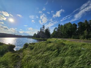
Photos: Blue skies and sunshine return along the Gunflint Trail and in Grand Marais
7 p.m., Monday
It looks and feels like summer again on the North Shore.
Over the past three days, air quality and smoke conditions have improved, producing blue skies and sunshine, a welcome sight for many.
Read more in a WTIP article here: https://wtip.org/smoke-eases-revealing-blue-skies-across-cook-county-as-air-quality-fluctuates/
Photos by Kalli Hawkins


Officials share latest on Little Knife Fire at second Gunflint Trail public meeting
5 p.m., Monday
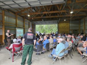
The U.S. Forest Service, in collaboration with the Gunflint Trail Volunteer Fire Department and county officials, held a second informational meeting about the Little Knife Fire on Monday, July 20, at 3 p.m.
Officials provided the latest updates on the Little Knife Fire and described ongoing operations, current weather, and more.
The National Incident Management Organization (NIMO) assumed control of the Little Knife Fire at 6 a.m. on Sunday. Several NIMO officials spoke during the meeting after conducting several helicopter flights over the Little Knife Fire on Sunday and Monday.
Link to video: https://youtu.be/rTmjkF0VXY4?si=Bh3ncNRx-lPYMyp8
A recording of the meeting is below:

Forest Service evaluating partial reopening of BWCAW
2:35 p.m., Monday
The U.S. Forest Service said it is evaluating whether portions of the Boundary Waters Canoe Area Wilderness can safely reopen.
During a Monday press conference, Superior National Forest Supervisor Tom Hall said officials are reviewing the current closure, which remains in effect through Friday, July 24, to determine whether some areas can reopen
“At this time we are assessing opportunities to reduce the closure in the areas that make the most sense,” Hall said during the press conference. “Right now we don’t have the timing of exactly what that will look like or when that will occur, but that is something we’re working on presently.”
Read more in a WTIP article here: https://wtip.org/forest-service-evaluating-partial-reopening-of-bwcaw/
NWS celebrates rain, but wind and air quality could worsen conditions
9:45 a.m., Monday
Thunderstorms moved through Cook County on Monday morning, bringing between a quarter-inch and a half-inch of rain, according to the National Weather Service.
National Weather Service meteorologist Holly Heikkinen joined WTIP on Monday morning to discuss how the changing weather could affect the ongoing wildfires across northeastern Minnesota.
While the rain provided some relief, Heikkinen cautioned that thunderstorms also bring lightning, which can ignite new wildfires.
“That’s one of the things that we’re concerned about when these thunderstorms come through is the lightning,” Heikkinen told WTIP. “As of right now, we’ve not been made aware that lightning caused any addition any additional wildfires.”
Temperatures near the fires are expected to climb into the mid-80s later this week, prompting another heat advisory for portions of Cook County. Combined with wind, the warmer weather could continue to create favorable conditions for wildfire activity despite the recent rainfall.
Air quality, which improved over the weekend, may also deteriorate again as winds shift.
“Winds are going to shift to the northwest and north for tomorrow and Wednesday, and that’s kind of what’s going to drive that smoke back down into the area,” Heikkien said.
Meanwhile, the Minnesota Department of Natural Resources activated Class IV burning restrictions beginning at 12:01 p.m. Monday for Cook, Koochiching, Lake and northern St. Louis counties because of ongoing wildfire conditions.
Under the restrictions:
- Campfires or recreational fires are not allowed.
- No burning permits will be issued except for special exceptions issued by the state or federal agency having suppression responsibilities.
- Prescribed burning on private lands is prohibited.
- Fireworks may not be used outside of municipalities. Use of fireworks within a municipality remains under the municipality’s control.
- Welding, acetylene torches, or other devices with open flame are prohibited in proximity to combustible vegetation, except under special permits.
- Only gas or propane camp stoves may be used in the backcountry or at campsites.
- Charcoal fires are allowed, in a grill designed for that purpose, at occupied homes, cabins and resorts.
WTIP’s CJ Heithoff spoke with meteorologist Holly Heikkinen during North Shore Morning. That audio is below.
Acreage of Little Knife Fire updated on Monday to 4,958 acres – new map shows perimeter
8:40 a.m., Monday
On Monday morning, Public Information Officers Steve Long and Sadie Brown, who are assisting the Forest Service with response to the Little Knife Fire, stopped by WTIP to share an update on the wildfire.
Forest Service aircraft were able to conduct a comprehensive aerial flight using infrared technology to gain better data on the wildfire. As of Monday, Forest Service officials said the wildfire has burned 4,958 acres. The latest estimate is a downgrade from the previous estimate of 6,000 acres. A map below shared with WTIP shows the perimeter of the Little Knife Fire as of Monday.
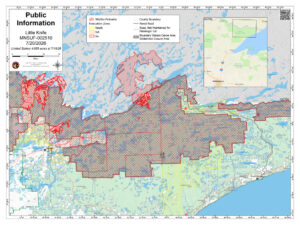
The Little Knife Fire originated from two Canadian wildfires that merged near Ottertrack and Knife Lake near the U.S./Canada border. Last week, the fire crossed the border into the U.S.
Between the U.S. and Canada, the fire has burned nearly 90,000 acres, Forest Service officials said on Saturday morning. The National Incident Management Organization (NIMO) took control of the Little Knife Fire at 6 a.m. on Sunday. See information below about a Gunflint Trail public meeting on Monday.
WTIP’s CJ Heithoff spoke with PIOs Steve Long and Sadie Brown live on North Shore Morning. Audio of the conversation is below.
*In the interview, Long states the size of the Little Knife Fire as 3,345 acres. Long contacted WTIP after the interview with a corrected size of the fire at 4,958 acres.
Little Knife Fire – Gunflint Trail Public Meeting Scheduled for Monday
7:30 a.m., Monday
The U.S. Forest Service in collaboration with the Gunflint Trail Volunteer Fire Department and county officials are holding a second informational meeting about the Little Knife Fire on Monday, July 20 at 3 p.m. Officials will provide the latest fire updates and talk about current conditions. The public will have an opportunity to ask questions.
The meeting will be held at the Schaap Community Center. Due to limited available seating and the large turnout at the first information meeting, officials are encouraging the public to bring a folding or camping chair, if possible.
For the public that is unable to attend the meeting, WTIP will be live streaming via video and audio on the WTIP Facebook page. Link here: https://www.facebook.com/WTIPNorthShoreCommunityRadio/
WTIP will also be live broadcasting the public meeting on our frequencies: 90.7 FM WTIP Grand Marais, 90.1 FM WGPO Grand Portage, and 89.1 WKEK Gunflint Lake. The live broadcast will be available via streaming on our website wtip.org and on the WTIP App. Access the WTIP website here: www.wtip.org.
Lutsen Township Public Meeting on Tuesday, July 21
The U.S. Forest Service and county officials will hold a community informational meeting about the Little Knife Fire on Tuesday, July 21 at 7 p.m. during the Lutsen Town Board Meeting. The location is Lutsen Town Hall (116 Caribou Trail.) The meeting is open to the public. WTIP will be live broadcasting and livestreaming the meeting the meeting.
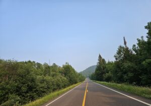
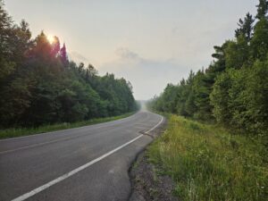
Photos: Smoke conditions improved in Cook County over the weekend
On Friday and throughout the weekend, blue skies and sunshine greeted the Gunflint Trail and areas across Cook County.
Photos along the Gunflint Trail by Kalli Hawkins below:
BWCAW closures extended through Friday, July 24
5 p.m., Saturday
Forest Service officials have extended the BWCAW closures to Friday, July 24, for all permit types due to the continued wildfire activity across the Superior National Forest.
While the BWCAW received rainfall on Friday, between 1/2 inch and 1 inch, conditions continue to remain dry. Hot and dry conditions, creating critical fire weather, are expected to continue this weekend and into early next week. The Forest Service said in a Saturday evening press release that “Crews anticipate continued fire growth as fuels dry out and winds increase.”
“Wildfire smoke and extreme fire behavior create serious risks for anyone traveling in the Boundary Waters,” said Drew Stroberg, Acting Forest Supervisor, Superior National Forest. “Even short-term exposure to heavy smoke can trigger breathing problems, especially for children, older adults, and people with heart or lung conditions. In remote wilderness terrain, unpredictable fire activity makes evacuations dangerous and rescue operations very challenging—especially during severe drought and weather conditions.”
As of Friday, there are 16 active wildfires throughout the Superior National Forest, with 3 inside the Boundary Waters Canoe Area Wilderness (BWCAW). Over 500 firefighters and support personnel are involved in these fires, with additional resources arriving daily. In addition, more than 16 state and local fire departments are involved in firefighting efforts.
On Friday evening, the Forest Service said in a press release that approximately 13,000 lightning strikes were detected with the storms that moved through northern Minnesota on Friday morning. New fires may be detected in the coming days.
Little Knife Fire
The latest estimated size of the fire on the U.S. side is 6,000 acres. The Little Knife Fire has burned as far south as Ogishkemuncie Lake, approximately four miles from the western edge of Seagull Lake. The Little Knife Fire originated from two Canadian wildfires that merged near Ottertrack and Knife Lake near the U.S./Canada border. Earlier this week, the fire crossed the border into the U.S.
Between the U.S. and Canada the fire has burned nearly 90,000 acres, Forest Service officials said on Saturday morning.
Authorities have uploaded the fire perimeter map on the Watch Duty website (WatchDuty.org) and on other official fire websites like InciWeb. (inciweb.wildfire.gov).
Voyageur Canoe Outfitters navigates business impacts from BWCAW closures, wildfires
1:34 p.m., Saturday
WTIP’s Kalli Hawkins stopped by Voyageur Canoe Outfitters on Friday to speak with owners Matt and Cassidy Ritter about how the Boundary Waters Canoe Area Wilderness closures and nearby Little Knife Fire are impacting the business. The Ritters talked about what happened the day after they received an email from the U.S. Forest Service stating the upcoming closure, process of evacuations, and how the business is navigating the situation day by day.

Matt and Cassidy Ritter, owners of Voyageur Canoe Outfitters | Photo by Kalli Hawkins
WTIP visits Sawbill Canoe Outfitters to learn how the BWCAW closures are impacting the business
Below is the full audio interview and a video posted to the WTIP Facebook page.
Forest Service official provides Saturday, July 18, overview of wildfires
WTIP Speaks with Public Information Officers on Saturday, July 18, about Little Knife Fire
Public Information Officers assisting the Forest Service with response to the Little Knife Fire stopped by WTIP at 9:10 a.m. on Saturday, July 18, to provide an update on fire resources arriving in Cook County this weekend, and an update on the Little Knife Fire following the Friday Gunflint Trail public meeting. WTIP spoke with PIO’s Steve Long and Sadie Brown.
Photos & Video: Over 100 people attend Forest Service public meeting about Little Knife Fire
4:45 p.m., Friday
Over 100 Gunflint Trail residents, lodge & outfitter owners, business owners, county officials, and community members attended the Friday afternoon Forest Service public meeting at the Schaap Community Center near mid-trail of the Gunflint Trail to learn about the Little Knife Fire. Photos by Kalli Hawkins below.
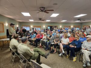
Gunflint District Ranger Kyle Stover speaking during public meeting
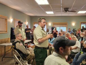
Laurentian District Ranger Adam Cochran
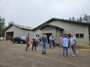
Residents and community members at the Gunflint Trail Fire Hall #1 and Schaap Community Center
Video via Facebook below. Video by Chuck Olsen.
Link to full audio clip of the public meeting:
Minnesota Senators join U.S. Representative in addressing public
3:47 p.m., Friday
Ely Mayor Heidi Omerza was joined by Minnesota’s U.S. senators and U.S. Rep. Pete Stauber in a unified show of support for the region. The officials called for economic assistance and acknowledged the continued threat posed by wildfires burning across the Arrowhead region.
U.S. Sen. Amy Klobuchar echoed Omerza’s call for people to support Ely businesses when conditions allow.
“People don’t need a bunch of donuts right now,” Klobuchar said. “People need to continue, when they can, when the air is OK, to come up to Ely.”
Klobuchar said officials were collecting data to determine whether the emergency qualifies for federal assistance.
Stauber emphasized unity among the elected officials.
“This is Minnesota at its best. We can have our differences. We are coming together,” Stauber said. “I couldn’t be more proud to represent this area, to see the success that we’re having. We’re still not out of the woods.”
USFS Press conference highlights the challenge of resources and the importance of weather
3:00 p.m., Friday
During a U.S. Forest Service press conference in Ely, speakers highlighted the challenge of resources and the dependence on weather to fight the fires burning across the northland.
Paul Lundgren of the Minnesota Department of Natural Resources addressed the media about the resources required to fight the fire currently burning over 90,000 acres.
“Success is really cooperation and continued communication and coordination,” Lundgren said. “And so when we bring people in, not only the firefighters, it’s important that we bring in the management structure.”
Phil Manuel of the National Weather Service advised the public that the rainstorm that passed through Cook County did not extinguish the fires.
“Don’t think just because the air cleared that you can run in, business as usual; that does not happen, not with fires of this size. So this momentary pause,” Manuel said.
Audio below of Jason Loomis, an incident commander with National Incident Management Organization (NIMO) providing a Friday update on the Camp Fire, Thumb Fire, Bear Trap Fire and the Sioux Fire across northern Minnesota.
WTIP will livestream on Facebook and live broadcast Gunflint Trail Public Meeting on Friday
11 a.m., Friday
The Gunflint Trail Volunteer Fire Department, in collaboration with the U.S. Forest Service, will hold a meeting at the Gunflint Trail Fire Department Hall #1 next to the Schaap Community Center on Friday at 3 p.m.
The public is invited to attend to learn about the latest updates on the Little Knife Fire and current conditions, and to ask questions.
“We know that information is comforting, and so we want to provide any and all information that we have at that moment,” said Public Information Officer Steve Long, who is assisting the Forest Service with Little Knife Fire response efforts.
For the public that is unable to attend the meeting, WTIP will be live streaming via video and audio on the WTIP Facebook page. Link here: https://www.facebook.com/WTIPNorthShoreCommunityRadio/
WTIP will also be live broadcasting the public meeting on our frequencies: 90.7 FM WTIP Grand Marais, 90.1 FM WGPO Grand Portage, and 89.1 WKEK Gunflint Lake. The live broadcast will be available via streaming on our website wtip.org and on the WTIP App. Access the WTIP website here: www.wtip.org.
Long and Public Information Officer Sadie Brown arrived in Grand Marais on Thursday as the Forest Service added personnel and resources to support the response to the Little Knife Fire burning near the end of the Gunflint Trail.
The Little Knife Fire originated from two Canadian wildfires that merged near Ottertrack and Knife Lake near the U.S./Canada border. Earlier this week, the fire crossed the border into the U.S.
The latest estimated size of the fire on the U.S. side is 6,000 acres. The Little Knife Fire has burned as far south as Ogishkemuncie Lake in Lake County, approximately four miles from the western edge of Seagull Lake.
At 9:40 a.m. Friday, Long said dense smoke and cloud cover have largely prevented aircraft from gathering updated acreage estimates, leaving the Forest Service with limited information on the fire’s size. The Forest Service did conduct an infrared flight on Thursday.
“The success of the flight was limited,” Long said Friday morning.
Little Knife Fire – Gunflint Trail Public Meeting Scheduled for Friday
9:40 a.m. Friday
The Gunflint Trail Volunteer Fire Department in collaboration with the U.S. Forest Service will hold a meeting at the Gunflint Trail Fire Department Hall #1 next to the Schaap Community Center on Friday at 3 p.m. The public is invited to attend to learn more about the latest updates regarding the Little Knife Fire, current conditions, and ask questions.
“Everyone is welcome. Please pass this on to your neighbors,” said the Gunflint Trail Volunteer Fire Department.
WTIP spoke with Public Information Officer Steve Long live on North Shore Morning at 9:40 a.m. on Friday, July 17, for the latest information on the Little Knife Fire and about the Friday public meeting. Audio below.
Photos: Smokey skies in Grand Marais
Photos of smokey skies over the Grand Marais harbor and along the Gunflint Trail this week. Photos by Dennis Chick.


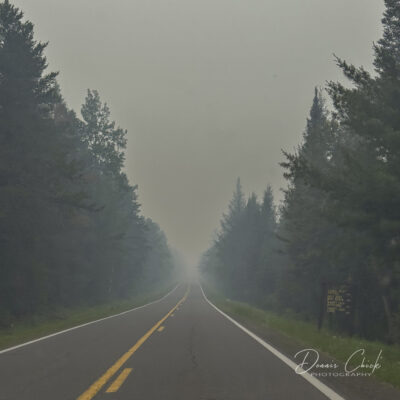
Additional Forest Service personnel and resources arrive in Grand Marais
1 p.m., Thursday
Two U.S. Forest Service public information officers and additional resources arrived in Grand Marais on Thursday afternoon to respond to the Little Knife Fire.
The Little Knife Fire originated from two Canadian wildfires that merged near Ottertrack and Knife Lake near the U.S./Canada border. Overnight on Tuesday, the fire crossed the border into the U.S.
With the fire now burning within the U.S., officials with the Forest Service have begun deploying resources and personnel and begun suppression efforts. The latest estimated size of the fire on the U.S. side is 6,000 acres. The Little Knife Fire has burned as far south as Ogishkemuncie Lake in Lake County, approximately four miles from the western edge of Seagull Lake.
Steve Long and Sadie Brown are the two new personnel stepping into the role to assist with communication and information coordination amid the Forest Service’s response to the Little Knife Fire.
Long and Brown, joined by Gunflint District Ranger Kyle Stover and Laurentian District Ranger Adam Cochran, stopped by WTIP shortly after noon Thursday. Long and Brown will be stationed at the Gunflint District Ranger station in Grand Marais.
Stover said as of noon on Thursday, Forest Service aircraft have been unable to fly near the Little Knife Fire due to the heavy smoke and poor visibility. When visibility and smoke conditions improve, the Forest Service plans to conduct an aerial flight to get a better estimate of the fire’s size and its behavior.
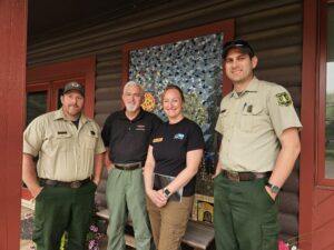
U.S. Forest Service Personnel Adam Cochran, Steve Long, Sadie Brown, Kyle Stover stop by WTIP | Photo by Kalli Hawkins
Read the full WTIP article here: https://wtip.org/additional-forest-service-personnel-and-resources-arrive-in-grand-marais/
Cook County firefighters respond to wildfires near Ely
Noon, Thursday
Several Cook County based firefighters are assisting with wildfire response near Ely. WTIP’s Chuck Olsen spoke with Schroeder Fire Chief Cody DeWandeler and Lutsen firefighter Brad Vandoren in Ely.
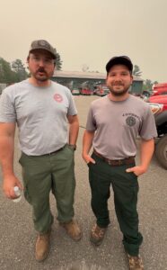
(L-R) Cody and Brad | Photo by Chuck Olsen
WTIP Speaks with National Weather Service
9:30 a.m., Thursday
WTIP spoke with Woody Unruh, a meteorologist with the National Weather Service – Duluth about the air quality & smoke, the weekend forecast, and how wildfires can create it’s own weather. Rain is predicted in the Friday forecast, according to the National Weather Service.
Unruh, said, “While all rain is good rain, this won’t necessarily be like the rainfall that’s going to extinguish these wildfires. It’s going to help them, help the crews get a handle on them but it’s not going to totally shut down” the wildfires.
Outfitters report BWCAW closure extended through Sunday, July 19
9:30 a.m., Thursday
Sawbill Canoe Outfitters and Bearskin Lodge have advised permit holders that the closure of the Boundary Waters Canoe Area Wilderness has been extended through Sunday, July 19, for all permit types.
In a social media post, Bearskin Lodge said it had been informed that the U.S. Forest Service will continue to assess conditions daily.
“They hope to give at least 4 days notice of the permit cancellations, but can’t promise. That all seems reasonable,” the post said.
Sawbill Canoe Outfitters announced that it will adjust its business hours to 8:30 a.m. to 5 p.m. and begin taking additional steps to reduce wildfire risk on its property.
The BWCAW was initially closed July 14 because of wildfire activity in and around the wilderness. The Forest Service automatically refunded affected permit holders and notified them by email.
Business closures throughout Cook County for Thursday, July 16
9:17 a.m., Thursday
Trails End Campground Closed
The Superior National Forest is temporarily closing public access to Trails End Campground at the end of the Gunflint Trail after a surge of wildfires across the forest and unusually hot, dry, and windy weather is causing fires to spread fast and unpredictably. The campground is closed from July 14 until July 19.
Birch Grove Community School Closed
All Birch Grove Programming is closed on Thursday, July 16, as Tofte is in the “Ready” evacuation area and Birch Grove is just outside the zone line.
The school will reevaluate this weekend concerning programming for next week. Those with questions can email birchgrove@boreal.org
First and Second Thrift Closed
First and Second Thrift has informed WTIP that they will be closed today.
Cook County Recycling and Budget Store Closed
Due to the continuing air quality incident, Cook County announced that the Cook County Recycle Center and Budget Shop will remain closed on Thursday, July 16.
While the Recycle Center is closed, the recycling drop-off sites throughout the county remain available for residents. See a list of drop-off sites here: https://cookcountymn.gov/government/departments/land_services/recycling/green_recycling_trailer_locations.php
The county hopes to resume normal operations when the air quality improves to a level safe for employees and the public.
If your business or service is being interrupted by the wildfire activity throughout the region or by air quality issues, you can contact the WTIP News Team at news@wtip.org.
National Weather Service air quality models for Thursday
8:35 a.m.
Hazardous air quality conditions are anticipated to continue through much of Cook County, according to the latest models from the National Weather Service, though certain areas may see improvement to “Moderate” conditions.
Cook County Sheriff’s Office updates evacuation orders across BWCAW for consistency
7:30 p.m., Wednesday
On Wednesday evening, the Cook County Sheriff’s Office added ‘Go!’ evacuation designation for the Boundary Waters Canoe Area Wilderness (BWCAW) throughout Cook County to improve consistency across the entire wilderness area and align with neighboring Lake and St. Louis Counties. The Sheriff’s Office said the added designation across the entire BWCAW better reflects the BWCAW closures, which went into effect on Tuesday, July 14.
The change in evacuation designation does not impact or affect any additional residences or private property, nor is it an indication of new threats from the Little Knife, Thumb, Sioux, Bear Trap, or Camp Fires, the Sheriff’s Office said.
Federal, state, and county agencies meet regularly to assess fire conditions and ensure advance warning is provided to the public about any future changes in the ‘Ready-Set-Go’ status.
The evacuation zone designation for the end of the Gunflint Trail remains at a ‘Set’ status.
The evacuation zone designation for the mid-trail area of the Gunflint Trail remains at a ‘Ready’ status.
Cook County uses the “Ready, Set, Go” method for emergency evacuations:
- READY means be ready for potential evacuation. Create an evacuation plan and ensure all household members are familiar with it. Gather all emergency supplies and create an emergency supply kit. Be up to date with your insurance and take a video home inventory. Closely monitor the situation.
- SET means to prepare to leave at a moment’s notice! Start packing your vehicle and back your car into the driveway to ensure quick and seamless evacuation. If you feel threatened, don’t wait for a final evacuation notice; just go!
- GO! Evacuate immediately! Make sure all household members are accounted for. Have several predetermined evacuation routes planned and choose the safest one. Head to your designated safe location (relative’s house, motel, etc.). GO!
See the changes on Watch Duty or Know Your Zone.
Forest Service adds firefighting resources to Little Knife Fire near end of Gunflint Trail
5 p.m., Wednesday
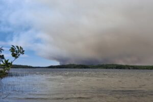
Smoke from Canadian wildfire as seen from Seagull Lake | Photo by Doug Turner
Overnight on Tuesday, two Canadian wildfires that have been burning near Ottertrack and Knife Lake merged and then crossed over the border into the U.S.
Now, on the U.S. side, it has been designated as the Little Knife Fire and has burned approximately 6,000 acres as of Wednesday morning. With the fire now burning within the U.S., officials with the U.S. Forest Service can respond and begin suppression efforts.
Gunflint District Ranger Kyle Stover told WTIP on Wednesday that additional Forest Service firefighting resources are being deployed to Cook County to respond to the Little Knife Fire. The Forest Service also plans to add two public information officer staff members who will assist with communication and information coordination.
On Wednesday afternoon, the wildfire is primarily moving in a north to south direction, Stover said. The Little Knife Fire has burned as far south as Ogishkemuncie Lake in Lake County, approximately four miles from the western edge of Seagull Lake.
Read more in a WTIP article: https://wtip.org/forest-service-adds-firefighting-resources-to-little-knife-fire-response-near-end-of-gunflint-trail/
Recreational sites towards end of Gunflint Trail close
4:50 p.m., Wednesday
Superior National Forest officials announced Wednesday evening that the Trails End Campground will temporary close due to wildfire activity in the area beginning July 15. The Trails End Boat Access will remain open. The Superior National Forest has closed the Seagull River Boat Access.
“This closure is about keeping people safe,” officials said in a press release. “Wildfires do not just threaten trees and campsites – they create dangerous smoke, unstable conditions, and rapidly shifting fire behavior that can trap visitors with little warning.”
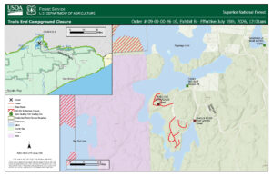
Wilderness Rangers continue sweeping efforts to evacuate BWCAW campers
4:45 p.m. Wednesday
Forest Service wilderness rangers are continuing to conduct sweeping efforts within the Boundary Waters Canoe Area Wilderness to inform and evacuate campers.
“I would say that we’re probably in the 90th percentile of people that we have reached,” said Tom Hall, the agency administrator for the Superior National Forest during a Wednesday press conference.
Hall said that the Forest Service recognizes that it takes “quite a bit of time” to reach BWCAW campers in more remote locations, and efforts will continue throughout the week.
“We are still looking to ensure that we’ve done our due diligence to make sure that they do get that notification,” Hall said.
Lake County Sheriff Shares Update on Evacuation Order & Camp Fire Conditions
4:30 p.m., Wednesday
Lake County Sheriff Nathan Stadler shared an update on evacuation orders in Lake County due to the Camp Fire. As of Wednesday, the fire has burned nearly 3,000 acres north of Ely.
The temporary evacuation point in Lake County is the Babbitt Municipal Center. Find the latest evacuation orders and information for Lake County here: https://experience.arcgis.com/experience/10688a627618414fa96159e8f70cba3c/page/Fire-Evacuation
More than 1,000 lightning strikes sparked widespread wildfire activity
4:15 p.m., Wednesday
“We had well over 1000 lightning strikes within the forest, within the Boundary Waters, and up into Canada through Ontario,” said Phil Manuel, the Incident Meteorologist with the National Weather Service, during a Wednesday Forest Service press conference.
The widespread lightning event that sparked so many of the active wildfires across the Superior National Forest and BWCAW occurred on July 6.
Manuel said that leading up to the July 6 event, there were already dry conditions, and then, following the lightning strike, a stretch of “hot, dry, windy” weather fueled the wildfires. “So all of those little lightning strikes became bigger and bigger, and we’re talking exponential growth.”
Ash continues to fall near mid-trail of the Gunflint
3 p.m. Wednesday
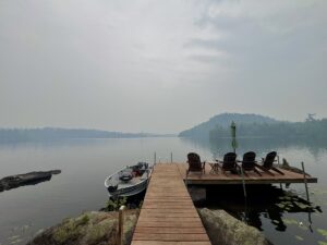
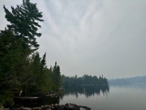
Photos below are of ash and smokey conditions on Hungry Jack Lake on Wednesday. Photos taken by Dennis Chick

Forest Service: July sees most fires, largest fire growth of season
The U.S. Forest Service held a press conference at 1 p.m. on Wednesday to provide updates on wildfires throughout northern Minnesota and the BWCAW.
Nick Petrack, the Forest Service fire management officer for the Superior and Chippewa National Forests, shared an update on wildfire conditions and response efforts.
Petrack said he’s spent 25 years working within the national forests and said that this is “probably the most and largest number of fires that I’ve seen in July.”
He emphasized that fire in the boreal forest is a “natural process”, but said the current wildfire activity has been fueled by a widespread lightning event that ignited numerous fires, combined with recent warm temperatures and minimal precipitation.
Petrack also said the current wildfires will be a “longer-term event” and that we should expect several of the more remote wildfires to continue burning into September.
WTIP speaks with Forest Service about Little Knife Fire
At 12:45 p.m., WTIP spoke with Gunflint District Ranger Kyle Stover for an update on the Little Knife Fire.
Overnight, the Canadian wildfire FOR028 and a neighboring wildfire, FOR012, merged and crossed over the U.S./Canada border. The fire is now being referred to as the Little Knife Fire and is estimated to have burned approximately 6,000 acres within the U.S. The wildfire is primarily within Lake County and is moving in a North/South direction. The Little Knife Fire has burned as far south as Ogishkemuncie Lake in Lake County.
The U.S. Forest Service said aircraft are supporting the fire but may be limited on Wednesday due to heavy smoke and poor visibility.
“They are hoping to try again this afternoon if things clear up enough to fly,” said the Cook County Sheriff’s Office.
Due to the southern expansion of the fire into the U.S., the Cook County Sheriff’s Office, in coordination with the Forest Service has decided to move the mid-trail area of the Gunflint Trail west of Hungry Jack Lake Rd and the northern parts of the townships of Schroeder, Tofte and Lutsen into “Ready” status.
The End of the trail is still in a “Set” status.
Code Red messaging will go out soon for the new “Ready” areas.
Minnesota Executive Council passes a 30-day extension of peacetime emergency
Gov. Tim Walz and members of the Minnesota Executive Council unanimously approved an extension of the peacetime emergency first declared Monday in response to wildfires burning across northern Minnesota.
“We need to remember when the smoke clears, this won’t be over,” State Auditor Julie Blaha said during a news conference addressing the wildfire situation in northern Minnesota. “We need to continue to make these communities whole.”
In addition to concerns about public safety, Walz and Blaha highlighted the economic impacts that closures in the Boundary Waters Canoe Area Wilderness and evacuations across the Arrowhead region could have on local businesses. Walz said the emergency declaration is intended, in part, to help provide resources to address those impacts.
“First and foremost, it’s protection of life and property,” Gov. Walz said during the news conference. “But we also need to recognize the economic impact to northern Minnesota is going to be felt because of the closure of the Boundary Waters.”
Walz also authorized the use of the state’s Disaster Contingency Account, which allows counties and local governments to apply for reimbursement of up to 75% of eligible emergency response costs. The fund is intended for disasters that do not meet the threshold for federal assistance.
Maps show Canadian wildfire has crossed over into U.S. near end of Gunflint Trail
At 9:48 a.m. Wednesday, the Canadian wildfire FOR028 was reported on Watch Duty as having crossed over into the U.S. The fire, now on the U.S. side, is listed as the Little Knife fire and is approximately 6,000 acres. Other sources, such as the Western Fire Chiefs Association, have maps showing the wildfire has crossed the border and is listed as the Little Knife Fire. The fire is also appearing on the ‘Know Your Zone’ Cook County Evacuation maps available here.
The Little Knife Fire is located approximately 7 miles from the western edge of Seagull Lake and about 11 miles from Chik-Wauk Museum and Nature Center, and other lodges and outfitter businesses near the end of the Gunflint Trail.
WTIP is waiting for an official update from the U.S. Forest Service and Cook County Sheriff’s Office. An update is expected shortly.
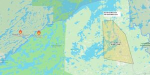
Cook County Sheriff Ben Hallberg told WTIP that the evacuation zone towards the end of the Gunflint Trail consists of approximately 147 properties. The evacuation status as of 10:42 a.m. Wednesday remains at ‘Set.’
Cook County uses the “Ready, Set, Go” method for emergency evacuations, here are the basics.
- READY for potential evacuation. Create an evacuation plan and be sure that all household members are familiar with the plan. Gather all emergency supplies and create an emergency supply kit. Be up to date with your insurance and take a video home inventory. Closely monitor the situation.
- SET to evacuate. Prepare to leave at a moment’s notice! Start packing your vehicle and back your car into the driveway to ensure quick and seamless evacuation. If you feel threatened don’t wait for a final evacuation notice, just go!
- GO! Evacuate immediately! Make sure all household members are accounted for. Have several predetermined evacuation routes planned and choose the safest one. Head to your designated safe location (relative’s house, motel, etc.). GO!
Learn more here: https://cookcountymn.gov/news_detail_T6_R842.php and https://cookcountymn.maps.arcgis.com/apps/webappviewer/index.html?id=2f0cb0740663455e9fe5c47b7fdb2379
Northern Minnesota wildfires have burned 55,000 acres
Gov. Tim Walz and state officials provided an update on the status of wildfire response across northern Minnesota on Wednesday during a press conference as wildfires continue to increase in size.
“Fires have grown quickly, and the situation is very dynamic,” said Sarah Strommen, the Minnesota Department of Natural Resources (DNR) Commissioner.
As of Wednesday, there are 17 active wildfires throughout the Superior National Forest and Boundary Waters Canoe Area Wilderness (BWCAW). A total of 55,000 acres has burned, said Strommen.
Weather conditions continue to be challenging for firefighters due to a combination of extreme heat, dry vegetation, and dry conditions.
Strommen said there are 150 firefighters responding to the northern Minnesota fires from state and federal agencies. In addition, there are 18 firefighting aircraft and 4 Minnesota National Guard helicopters providing aerial suppression support.
The wildfire environment across the state remains very active, Strommen said and will likely continue for “quite some time.” DNR and Forest Service officials said in the press conference that the agencies main focus is to protect lives and property and given the remote location of the BWCAW wildfires, it’s likely that authorities will let the wildfires continue to burn.
Gov. Walz said despite the scale and expansion of the wildfires there have been no reports of injuries or loss of life as of Wednesday.
Clean Air and Cooling Shelter Available in Cook County
10:40 a.m.
A clean air and cooling shelter will be available in the Cook County YMCA lobby area beginning at 9 a.m. on Wednesday, July 15, and will remain open until 7 p.m. unless changing fire conditions require a change in operations.
Community members who need relief from poor air quality or a cooler indoor space are welcome to use the shelter. The YMCA also serves as a checkpoint for residents who choose to leave their homes before an evacuation order through Law Enforcement’s “Ready, Set, Go” protocol. Staff from Cook County Public Health and Human Services will be at the YMCA to answer questions related to air quality, provide KN-95 masks to community members (as supplies last).
More information: https://cookcountymn.gov/news_detail_T6_R847.php
WTIP Speaks with National Weather Service – Duluth
WTIP spoke with the National Weather Service in Duluth on Wednesday morning to talk about the heavy smoke and “hazardous” air quality due to the wildfires in Canada and across the Superior National Forest.
Cook County Recycling Center and Budget Shop closed due to wildfire smoke
9:07 a.m.
Cook County announced that the Cook County Recycling Center and Budget Shop will be closed on Wednesday, July 15, due to poor air quality. In a news release, the county said the decision was made “to protect the health and safety of employees and the public.” County officials said they will continue to evaluate operations at the recycling center as air quality conditions change.
Fire reported on island at Crescent Lake in Cook County
6:45 a.m. Wednesday
A small fire on an island at Crescent Lake in Cook County was reported at approximately 6:45 a.m. on Wednesday. Firefighters and first responders reached the Crescent Lake Campground shortly after 7:30 a.m. The fire has burned between .5 to one acre on an island on Crescent Lake. Authorities said the fire is burning deep in “duff”. As of 8 a.m. authorities said there was no risk of it spreading to the mainland. The size of the island is 1.5 acres, according to the Tofte Fire Department.
Crescent Lake is located on Forest Road 170, also known as “The Grade.” It is located six miles from Cascade Lake and approximately six miles from Sawbill Lake.
WTIP will continue to provide updates on this fire.
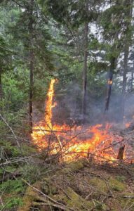
Crescent Lake fire | Photo by Tofte Fire Department
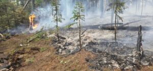
Crescent Lake fire | Photo by Tofte Fire Department
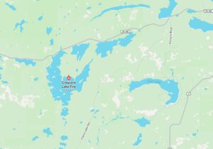
Location of Crescent Lake Fire
Gunflint Trail Canoe Races postponed due to wildfires and smoke
Organizers have postponed the Gunflint Canoe Races because of ongoing wildfire activity and evacuation orders along the Gunflint Trail. The races were scheduled to occur Wednesday, July 15 at 4:30 p.m.
The Gunflint Lake Property Owners Association and race organizers said they are working to identify a new date for the event.
Read more in a WTIP article here: https://wtip.org/gunflint-canoe-races-postponed-amid-wildfires-evacuation-orders/
Trails End Campground Closed
The Superior National Forest is temporarily closing public access to Trails End Campground after a surge of wildfires across the forest and unusually hot, dry, and windy weather is causing fires to spread fast and unpredictably. The campground is closed from July 14 until July 19.
Smoke expected to continue through Wednesday
Below is one model depiction of the general timing of smoke through today in the Northland. Air Quality Alerts are in effect today and Thursday. The National Weather Service said the public should expect smoke at least into Thursday.
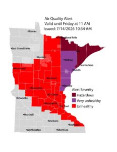
An air quality alert has been issued due to wildfire smoke for Tuesday, July 14, through Friday, July 17, for east central, central, west central, southeast, north central, northwest, and northeast Minnesota.
Small grass fire near Poplar Lake on Tuesday afternoon
The Gunflint Trail Fire Department responded to a report of a grass fire at about 5 p.m. Tuesday near 69 Voyageurs Point near Poplar Lake. The fire stemmed from a propane tank, then spread to the surrounding grass. Firefighters were able to put the fire out quickly. There was no damage to structures or injuries.
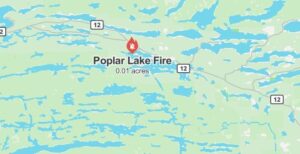
Gunflint Trail and Grand Marais businesses still welcoming guests
Although there is heavy smoke presence and an increased awareness regarding wildfire preparedness in Grand Marais and across the Arrowhead region and a closure in the BWCAW, businesses in town and throughout the county are still open and welcoming customers.
“The Gunflint Trail is open and our businesses, lodges, restaurants, and outfitters are here and ready to welcome you,” said representatives with the Gunflint Trail Association on it’s Facebook page.
The association said, “While the Boundary Waters Canoe Area Wilderness remains temporarily closed due to wildfire activity and out of an abundance of caution, the Gunflint Trail community is still very much open. We know this closure is disappointing for many visitors and our thoughts are with everyone affected, including those working tirelessly to keep people and this incredible place safe.”
Cook County Sheriff’s Office – Tuesday Evening Update
7:40 p.m.
U.S. Forest Service crews flew an aerial flight near the Canadian FOR028 wildfire at approximately 5 p.m. Tuesday evening.
“They were able to fly a plane with infrared camera technology to get a better view of the fire,” the Cook County Sheriff’s Office said. “The fire has not moved into the U.S. yet but again is close to crossing at the Monument Portage and would expect it to overnight.”
The Sheriff’s Office said, “With the wind direction change, we are receiving a large amount of smoke and ash from this fire along with a number of other fires in Canada.”
The wildfire smoke is expected given the expansion of wildfires across the northern Minnesota region and across Quetico Provincial Park.
The Sheriff’s Office said it will post any additional information as it is made available. “Please be safe, stay indoors due to the smoke if possible, and no campfires please,” the Sheriff’s Office said.
WTIP Speaks with Cook County Sheriff about wildfire & evacuations
WTIP’s Kalli Hawkins spoke with Cook County Sheriff Ben Hallberg at 5 p.m. on Tuesday, July 14 for an update following the raised evacuation designation to ‘Set’ and following the growth of the Canadian wildfire FOR028. The Cook County Sheriff’s Office, Forest Service, county officials, and other agencies will be holding an evening briefing at 6 p.m. on Tuesday after an aerial flight near FOR028 this evening. Additional information will be released this evening.
Heavy Smoke Blankets Grand Marais and Arrowhead Region
4 p.m.
Heavy smoke rolled across the northeastern region and into Grand Marais on Tuesday evening. Ash was reported falling from the sky near Devil’s Track Lake and at the WTIP radio station.
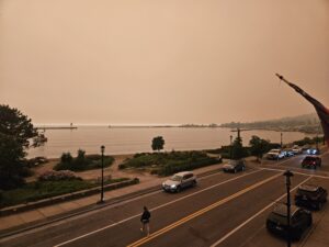
Smoke from downtown Grand Marais on Tuesday evening | Photo by Kalli Hawkins
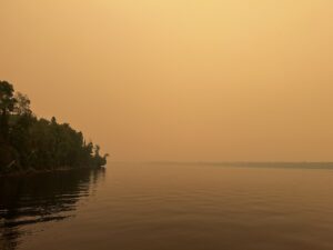
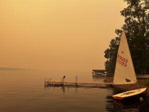
WTIP Listener Leah Lado sent WTIP photos of the wildfire smoke. Her and her husband, Malik Stewart are staying at Loon Lake Lodge up the Gunflint Trail for their fifth wedding anniversary (and our fourth trip to Loon Lake).
The clear photo was taken Sunday when they arrived at Loon Lake Lodge, and the second photo was taken 48 hours later at about 3 p.m. Tuesday, both looking west from the dock.
Lado said, “We’re safe and the lodge owners are monitoring the situation. It’s raining ash onto the deck of our cabin. We kayaked Little Iron Lake this morning and it was smoky but not awful, then went to go for a swim this afternoon and it looked like a scene from a post-apocalyptic movie. Hoping everyone stays safe!”
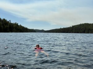
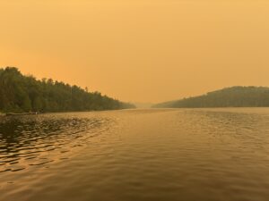
WTIP Listener and board member Peter Clissold shared photos from Devil’s Track Lake as of Tuesday evening.
How does the Forest Service evacuate the BWCAW?
Superior National Forest Wilderness Manager Carl Skustad discusses wilderness rangers sweeping and assisting with BWCAW visitors out of the BWCAW closure areas.
Forest Service monitoring prescribed burn near Greenwood Lake
3:37 p.m.
The Forest Service continues to monitor the prescribed burn near Greenwood Lake amid ongoing dry conditions and red-flag warnings.
Over the weekend, a 775-acre prescribed burn unit completed by the U.S. Forest Service in late May flared up, producing considerable visible smoke near Greenwood Lake.
As of Tuesday morning, the prescribed burn remains within its planned perimeter and footprint, Gunflint District Ranger Kyle Stover said during a wildfire update at the July 14 Cook County Board of Commissioners meeting.
Helicopters have conducted water bucket drops to cool hot spots along the perimeter lines. The Forest Service has also implemented a sprinkler system along the western boundary of the fire line, adjacent to private property, and is actively working with property owners. “And that was successful,” Stover said.
Stover said, “We are there daily with engines and watercraft, and having it checked by aerial detection that we have regularly every day at this point.”
Visible smoke is present in the immediate vicinity and, depending on wind currents, may be visible from areas farther away, such as Devilfish Lake Campground and Esther Lake Campground up the Arrowhead Trail.
Read more in a WTIP article here: https://wtip.org/forest-service-daily-monitoring-prescribed-burn-near-greenwood-lake-and-airport-pit-fire/
Lake County expands evacuation zones
The Lake County Sheriff’s Office, in coordination with the U.S. Forest Service, expanded the evacuation zone, which will now include the area between Fall Lake and Cedar Lake. The zone is titled “North Fall Lake – 2A” on the evacuation zone map located on the Lake County website. The evacuation status for this area has been elevated to ‘Go.’ Residents and visitors should leave immediately.
Lake County Evacuation Maps below:
https://experience.arcgis.com/experience/10688a627618414fa96159e8f70cba3c/page/Fire-Evacuation
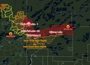
Evacuation Map Zone for Lake County
Wildfire Growth Update – Tuesday afternoon
3 p.m.
The growth of three wildfires grew significantly on Tuesday amid dry conditions and red flag warnings.
- Camp Fire
- Location: On the border of Lake & St. Louis County – northeast of Ely and Winton
- Size: 2,200 acres
- Thumb Fire
- Location: Between Thumb and Contentment Lake in the Boundary Waters Canoe Area Wilderness
- Size: Nearly 12,327 acres
- Dark Fire / Bear Trap Fire
- Location: North of Ely North of Sunday Lake in the Boundary Waters Canoe Area Wilderness
- Size: 12,896 acres
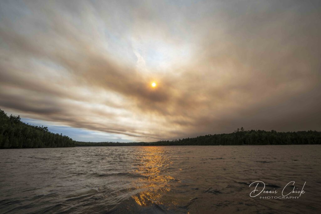
Photos from Hungry Jack Lake
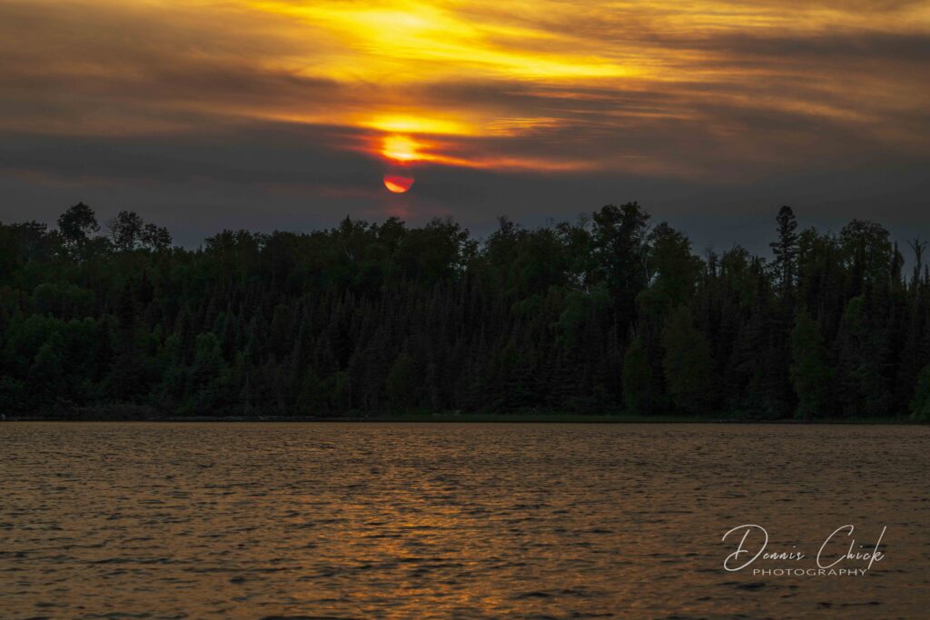
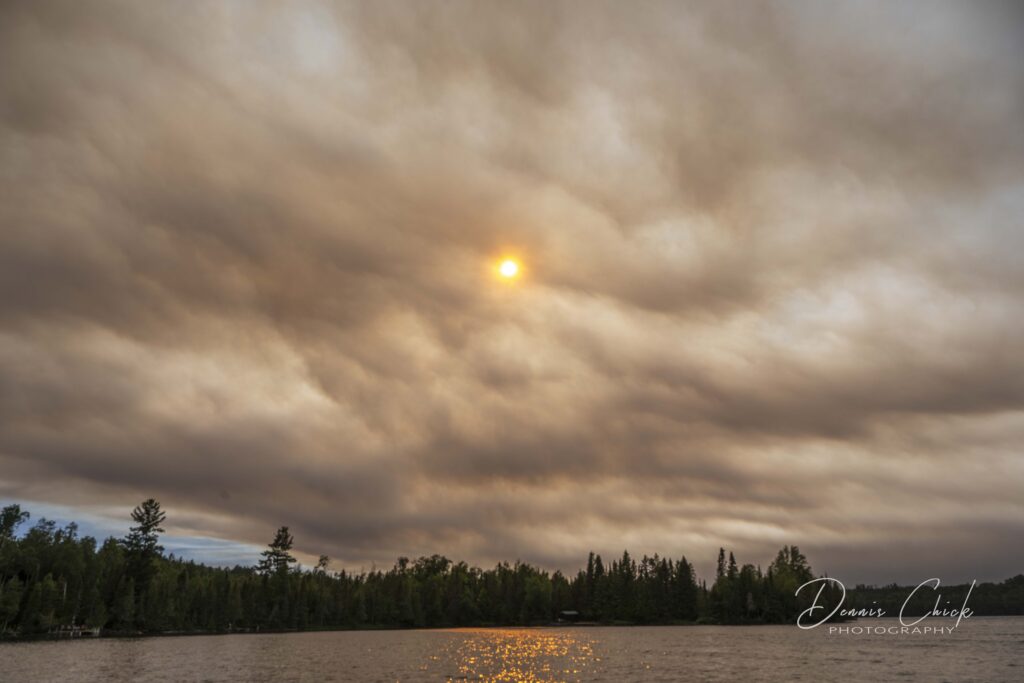
WTIP listener Dennis Chick submitted photos from last night and this morning on Hungry Jack Lake.
National Weather Service extends Air Quality Alert
2:33 p.m.
The National Weather Service has extended the Air Quality Alert for Minnesota to 11 a.m. on Friday. Conditions are expected to be “Hazardous” for much of the Arrowhead region.
According to AirGov, when the forecast is hazardous, everyone should stay indoors and reduce activity levels.
WTIP Speaks with WELY Radio in Ely, Minn. for update on wildfire conditions
U.S. Forest Service Wildfire Update – Two U.S. wildfires cross into Canada
2:10 p.m.
Currently, there are 17 active wildfires within the Superior National Forest, with 3 active fires inside the BWCAW and one new fire that began on Monday outside the BWCAW. On Monday, two of the fires crossed the International Border–the Bear Trap Fire and the Thumb Fire. The forest is coordinating with Canadian Authorities.
Video from Loon and Seagull Lake as wildfire smoke rolls in
2:05 p.m.
Listener Ryan Coleman of d3photography provided WTIP with the following video.
Sheriff’s Office raises evacuation designation to ‘Set’ for end of Gunflint Trail
1:15 p.m.
The Cook County Sheriff’s Office raised the evacuation designation to ‘Set’ at 1 p.m. Tuesday for residents and visitors near the end of the Gunflint Trail after a wildfire burning along the U.S.-Canada border increased in size.
An approximately 2,500-acre wildfire, called FOR028, is burning on the Canadian side of Ottertrack and Knife lakes along the U.S.-Canada border.
U.S. Forest Service personnel flew over the fire at around 10 a.m. on Tuesday and estimated the fire to be about 2,500 acres. As of 10 a.m. the wildfire had not crossed over to the U.S. side of the border, but was burning near the west side of the Monument Portage and near Swamp Lake.
The Forest Service said it expects the wildfire has crossed the border as of Tuesday afternoon, according to an announcement from the Cook County Sheriff’s Office.
Gunflint District Ranger Kyle Stover said during a wildfire update at the July 14 Cook County Board of Commissioners meeting that the area across the U.S. border is vulnerable for wildfires to expand rapidly.
“It’s been a long time since we’ve had any history in there,” Stover said. “It is in an area that was affected by the ’99 blowdown with balsam fir that came up underneath.”
Stover said that farther east towards the end of the Gunflint Trail, there is the Cavity Lake burn scar that hasn’t burned since 2006.
The Gunflint Trail Volunteer Fire Department is staging equipment and personnel at the Gunflint Trail Fire Halls as of Tuesday afternoon.
The Sheriff’s Office is advising residents and visitors to prepare to leave their home and property at a moment’s notice.
Stay updated on Know Your Zone: https://cookcountymn.maps.arcgis.com/apps/webappviewer/index.html?id=2f0cb0740663455e9fe5c47b7fdb2379
Read more in a WTIP article: https://wtip.org/sheriffs-office-raises-evacuation-designation-to-set-for-end-of-gunflint-trail/
Gunflint District Ranger Kyle Stover provides a wildfire update
Update provided to Cook County Board of Commissioners on July 14 about ongoing fire monitoring efforts within Cook County and an update on the Canadian FOR028 wildfire
Photos of wildfire smoke at Seagull Lake
12:23 p.m.
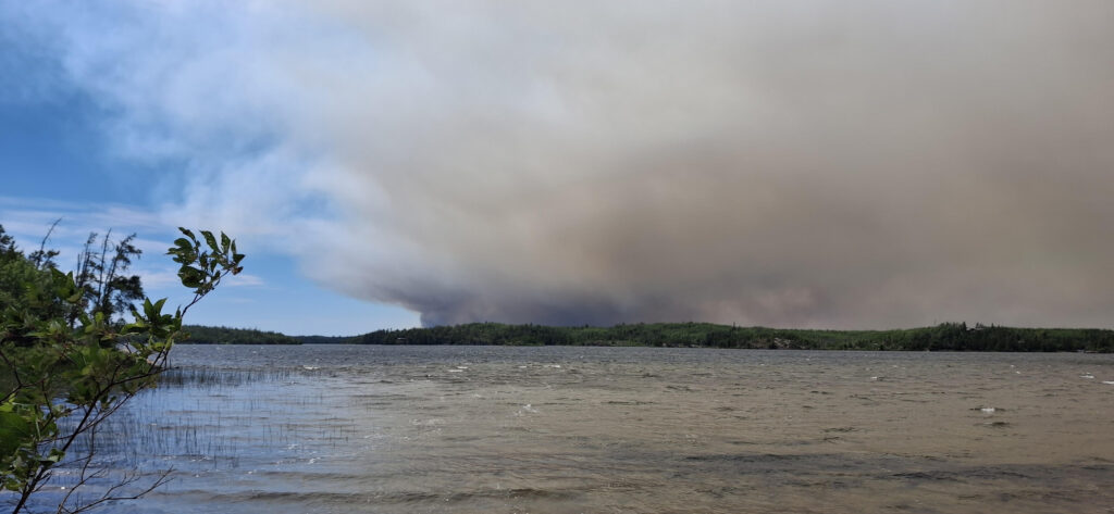
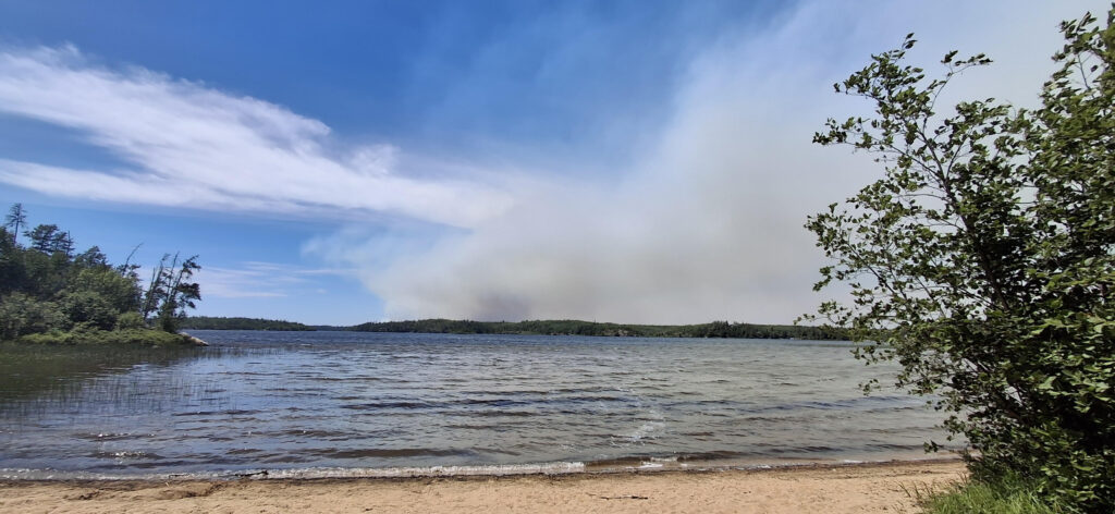
WTIP listener, Doug Turner, captured the following image of the wildfire smoke over Seagull Lake on Monday
Wildfires, air quality update
12:10 p.m.
Wildfires continue to burn across the Superior National Forest, prompting the first evacuation orders in Lake and St. Louis counties. Meanwhile, the National Weather Service has extended a Red Flag Warning until 9 p.m. Tuesday because of dry, windy conditions, and air quality alerts remain in effect across much of northeastern Minnesota.
During a July 13 press briefing, U.S. Forest Service officials identified two fires as particular concerns. The Camp Fire, north of Ely, was most recently reported at 2,127 acres. The FOR028 Fire, burning just across the Canadian border on Ottertrack Lake, was reported at 1,976 acres.
“In all likelihood, the only thing that’s going to put those out fully is snow,” Drew Stroberg, deputy forest supervisor at the U.S. Forest Service, said during the Monday press conference. “These things will likely be burning in some way, shape, or form until then. So when we reduce the size of the closure area, I do expect that we will have some level of closure in effect around those fires for the duration of the season.
The Lake County Sheriff’s Office, in coordination with the U.S. Forest Service, issued evacuation orders for multiple zones in the northern part of the county. An evacuation center has been established in Babbitt.
In St. Louis County, one evacuation zone was upgraded to “Evacuate” status at 11 p.m. Monday.
In Cook County, only one zone has received a Ready, Set, Go notification. The End of the Trail zone, which includes portions of Saganaga and Seagull lakes, was placed under “Ready” status at 7:36 p.m. Monday.
Cook County evacuation information is available through the county’s emergency management map.
An air quality alert has also been issued for Cook County as shifting winds are expected to carry wildfire smoke across much of the county and the Arrowhead region.
The National Weather Service released a weather model showing near-surface smoke trends through the remainder of Tuesday and into Tuesday night.
Gunflint Trail residents urged to prepare
As wildfire activity continues across northeastern Minnesota and just north of the U.S.-Canada border, Cook County officials are urging residents and property owners to be prepared.
The wildfire produced a visible smoke plume Sunday that could be seen from the Seagull Lake area, approximately 10 miles away, towards the end of the Gunflint Trail.
On Sunday evening, the Cook County Sheriff’s Office placed an area near the end of the Gunflint Trail under a “Ready” evacuation designation on the county’s ‘Know Your Zone’ website as a precaution should the wildfire cross the U.S.-Canada border.
“We want to make sure that residents are aware that this fire is not too far away from the end of the trail,” said Cook County Sheriff Ben Hallberg.
WTIP spoke with Ruth Wagner, a member of the Gunflint Trail Volunteer Fire Department and owner of Golden Eagle Lodge about how Gunflint Trail property owners can prepare for a wildfire by using sprinkler systems and other methods. Audio below.
Read a WTIP article here: https://wtip.org/authorities-encourage-wildfire-preparedness-along-gunflint-trail-and-across-the-county/
Wildfire activity intensifies
Read a WTIP article from Sunday evening here: https://wtip.org/wildfire-activity-intensifies-across-northern-minnesota-and-along-the-u-s-canada-border/
WTIP Staff July 28, 2026